World map of groundwater resources
‘Groundwater is the largest accessible and often still untapped freshwater reservoir on earth. Its world-wide resources are assessed at 10.5 million km³. The increasing number of regional water shortages and water crises can only be met with a rational and sustainable use of this resource. Such sustainable use requires understanding and knowledge as well as careful planning and management. Yet, information on this hidden resource is still weak in many places.
In order to provide data and information about the major groundwater resources of the world and thus make a contribution to their reasonable management and protection the World-wide Hydrogeological Mapping and Assessment Programme (WHYMAP) was launched in 2000.
The programme compiles data on groundwater from national, regional and global sources, and visualises them in maps, web map applications and services. The generated products provide information on quantity, quality and vulnerability of the groundwater resources on earth and help communicating groundwater related issues to water experts as well as decision makers and the general public.’ (Source)

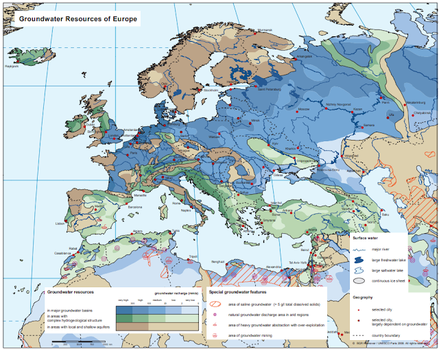
The world map of Groundwater Resources at the scale of 1 : 25 000 000 and 1 : 40 000 000 contains the related data known or published so far. It shows various groundwater environments in their spatialextent.
Blue colour is used for large and regionalgroundwater basins.
Green colour symbolises hydrogeological environments withcomplex geological structure.
Brown colour outlines areas with local and shallow aquifers.
The following maps are available on the website by clicking on the given themes on the page:
1. Groundwater Resources of the World (2008);
2. River and Groundwater Basins of the World (2012);
4. World Karst Aquifer Map (2017);
5. Additional maps can be downloaded in pdf format
Comments
Post a Comment